wasm-spatial-core
wasm-spatial-core
Generate Cesium 3D Tiles in the browser. Drag in a LAS / GeoTIFF / GLB,
get back a streaming tileset.json + pnts / quantized-mesh tiles — no
server, no upload, no Cesium ion quota. The data never leaves the user's
machine.


-success)

🌐 Live Demo · 📦 npm · 📖 API Docs · 📊 Head-to-head vs py3dtiles · 🗺️ Roadmap
🧪 30-second try (drop a .las file, get a Cesium tileset):
<script type="module">
import init, { parsePointCloudAuto, generateTileset }
from 'https://esm.run/wasm-spatial-core';
await init();
// User drops a LAS file → parse → octree → 3D Tiles.
// All in the browser. Bytes never touch a server.
const cloud = parsePointCloudAuto(lasFileBytes);
const tileset = generateTileset(cloud.positions(), 50000, 10);
// → { tilesetJson, tiles: Uint8Array[], ... } — feed straight into Cesium.C3DTileset
</script>
👥 Adopters
Building something with wasm-spatial-core? Add your project here — open an issue using the feature request template or edit this section directly.
(No production adopters listed yet — be the first. This section grows as the project gets real-world use.)
Why does this exist?
If you've ever tried to view a customer's LAS scan in Cesium, you've hit one of:
- Cesium ion wants you to upload their data — GDPR / ITAR / NDA say no.
- Desktop tools (CloudCompare, Q2C) need install + per-machine license + manual steps.
- Server-side pipelines (PDAL, untwine) mean infra cost + a backend to maintain.
- Just-plain-JS parsers choke at 1M+ points (multi-second hangs).
wasm-spatial-core is a Rust → WebAssembly engine that does the whole
LAS → octree → 3D Tiles pipeline client-side. The output is byte-compatible
with what Cesium.C3DTileset consumes — so you can build a zero-backend,
zero-upload Cesium viewer that runs on a static host.
| Cesium ion (SaaS) | Desktop tools | wasm-spatial-core | |
|---|---|---|---|
| Customer data leaves the browser | ☁️ yes (uploaded) | 💻 no (local) | 💻 no (local) |
| Deployable on intranet / air-gap | ❌ | per-machine | ✅ static files |
| Per-GB / per-user cost | ✅ yes | license fee | ❌ free (MIT) |
| Works inside a web app | ✅ | ❌ | ✅ |
| Streams multi-GB scans | partial | n/a | ✅ COPC range fetch |
Not a PROJ / QGIS replacement. CRS coverage is intentionally focused (WGS-84 / Web Mercator / UTM / China offsets). For arbitrary EPSG reprojection, pre-transform with PROJ and feed WGS-84 / ENU.
✨ Capabilities
Core (the killer use case):
- 🚀 LAS / PLY / OBJ → 3D Tiles (pnts) — octree partition + Draco optional
- 🏔️ GeoTIFF → Quantized-Mesh Terrain — Cesium
CesiumTerrainProvider-compatible (proven by headless test, see W3.6 inROADMAP_V2.md) - 📡 COPC range-fetch streaming — multi-GB scans without loading the whole file
Also in the box (used internally, exposed as public APIs):
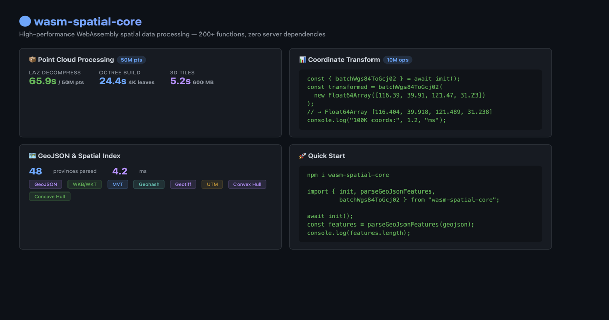
- 🗺️ Coordinate transforms: WGS-84 ↔ GCJ-02 / BD-09 / Web Mercator / UTM (~30–250× faster than JS equivalents — see PERFORMANCE.md)
- 🧊 Spatial IR + mesh edit: GLB ingest, OBB split, plane clip, QEM decimation
- ⚡ WebGPU compute kernels (with WASM fallback)
- 🔒 Zero server, zero upload, zero runtime dependencies
npm install wasm-spatial-core ships a prebuilt 1.2 MB WASM binary — no
native deps, no postinstall, works on any static host (GitHub Pages, S3,
nginx, even python -m http.server).
🌐 See it work
Live, drag-and-drop, no backend:
| Demo | What it shows |
|---|---|
| Cesium 3D Tiles | Drop a .las / .tif / .glb → octree → 3D Tiles → Cesium globe. The killer demo. |
| COPC streaming | Range-fetch a multi-GB .copc scan byte-range by byte-range (no full download). |
| Terrain viewer | GeoTIFF → quantized-mesh, with cut / flatten / fill edits. |
| Demo hub | All examples + benchmarks. |
Run any of them locally with npm run demo.
🚀 Quick Start: LAS → Cesium in 20 lines
npm install wasm-spatial-core
import init, { parsePointCloudAuto, generateTileset } from 'wasm-spatial-core';
// Cesium loaded separately (CDN or npm) — we only emit the tile bytes.
await init();
// 1. User drops a .las file. Parse it.
const cloud = parsePointCloudAuto(lasFileBytes);
// cloud.positions() → Float32Array [x,y,z, ...]
// 2. Build octree → 3D Tiles (pnts + tileset.json).
const tileset = generateTileset(cloud.positions(), 50000 /* max pts/node */, 10 /* depth */);
// tileset.tilesetJson() → string
// tileset.tile(i) → Uint8Array (one pnts blob per tile)
// 3. Hand the tiles to Cesium via blob URLs (no server needed).
const json = JSON.parse(tileset.tilesetJson());
for (let i = 0; i < tileset.tileCount; i++) {
const url = URL.createObjectURL(new Blob([tileset.tile(i)]));
json.root.content.uri = json.root.content.uri.replace(`tile_${i}.pnts`, url);
// (in practice, walk the tree and rewrite each leaf's content.uri)
}
const cesiumTileset = await Cesium.C3DTileset.fromUrl(
URL.createObjectURL(new Blob([JSON.stringify(json)], { type: 'application/json' })),
);
viewer.scene.primitives.add(cesiumTileset);
That's the whole story — no backend, no upload, no ion token. For a working drag-and-drop demo, see the Point Cloud + Cesium example.
Optional: Draco compression (~5× smaller tiles)
npm install draco3d
import { compressTilesetWithDraco } from 'wasm-spatial-core';
import { createEncoderModule } from 'draco3d';
const encoder = await createEncoderModule({});
const compressed = compressTilesetWithDraco(tileset, encoder, { quantizationBits: 11 });
// Typical ratio: ~20% of original size, position-color pairing preserved.
What's in the npm package?
npm install wasm-spatial-core ships a prebuilt WASM binary compiled with
point-cloud + geotiff. That gives you:
| Included in npm | Not in npm (custom wasm-pack build) |
|---|---|
| LAS, PLY, OBJ, PCD parsing | LAZ / COPC (laz-support) |
| Octree + 3D Tiles (pnts) | E57 (e57-support) |
| GeoTIFF → quantized-mesh terrain | Terrain deformation (terrain-edit) |
| Coordinates, GeoJSON, MVT, spatial analysis | Spatial IR + GLB ingest (mesh-ingest) |
Mesh QEM / clip / OBB split (mesh-edit, needs mesh-ingest) |
|
WebGPU compute kernels (webgpu) |
Format counts: 10+ read/write paths in the default npm build (LAS/PLY/OBJ/PCD, GeoJSON, MVT, WKT/WKB, GeoTIFF, GPX, TopoJSON, 3D Tiles/glTF output, …). 15+ when optional format features are enabled (LAZ/COPC, E57, GLB ingest, …).
Runtime checks: supportsLaz(), supportsGeotiff(), lazStatus().
CI runs cargo test --all-features — 857 tests pass (plus 34 #[ignore]d performance benchmarks) across the full feature matrix. The live count is printed by CI on every run; see the latest rust job log for the current number.
🎯 Core Pipelines
Point Cloud → 3D Tiles
LAS / PLY / OBJ (npm default)
LAZ / COPC / E57 (optional build features — see table above)
│
▼
┌──────────────┐
│ WASM Parser │ Browser-side; format set depends on build features
└──────┬───────┘
▼
┌──────────────┐
│ Octree Build │ 8-way spatial partitioning
└──────┬───────┘
▼
┌──────────────┐
│ pnts Encoder │ 3D Tiles Point Cloud binary
└──────┬───────┘
▼
┌──────────────┐ ┌──────────────┐
│ tileset.json │ │ Draco Compress │ Optional (~20% ratio)
└──────┬───────┘ └──────┬───────┘
│ │
▼ ▼
Cesium / Three.js — interactive 3D
GeoTIFF → Terrain Tiles
GeoTIFF (.tif)
│
▼
┌──────────────┐
│ WASM Parser │ Float32/16/8, strip/tile, DEFLATE
└──────┬───────┘
▼
┌──────────────┐
│ Quantized-Mesh │ Cesium terrain binary format
└──────┬───────┘
▼
┌──────────────┐
│ tileset.json │ LOD pyramid (zoom 0..N)
└───────────────┘
⚡ Performance
The whole reason this exists: do in-browser what previously needed a server. On Apple M2, single-thread WASM (no WebGPU):
| Dataset | Points | Parse | Octree + Tileset | Total |
|---|---|---|---|---|
| sample.las | 1K | — | < 1 ms | — |
| Synthetic | 500K | 36 ms | 166 ms | 205 ms |
| Synthetic | 10M | 1.1 s | 3.6 s | 4.8 s |
| Synthetic | 100M | 0.4 s | 6.8 s | 8.5 s |
100M-point number is native release (Rust); WASM is ~1.5× slower but still well under 30 seconds. Compare: potree (JS) takes ~3 s just for octree at 1M.
Coordinate conversion (the same engine, different workload):
| Operation | Pure JS | WASM | Speedup |
|---|---|---|---|
| WGS84 → GCJ-02 | ~1,200 ms | ~45 ms | ~27× |
| WGS84 → Mercator | ~800 ms | ~12 ms | ~67× |
See PERFORMANCE.md for full methodology + comparison with potree / three.js Octree / las-js.
📦 Format Support
Point Cloud
| Format | Read | Feature Flag |
|---|---|---|
| LAS (1.2–1.4, Format 0–6) | ✅ | point-cloud |
| LAZ (compressed) | ✅ | laz-support |
| COPC (Cloud Optimized) | ✅ | laz-support |
| PLY (ASCII + binary) | ✅ | point-cloud |
| OBJ | ✅ | point-cloud |
| PCD (ASCII + binary) | ✅ | point-cloud |
| E57 | ✅ | e57-support |
Vector & Geometry
| Format | Read | Write |
|---|---|---|
| GeoJSON | ✅ | ✅ |
| MVT (Vector Tiles) | ✅ | ✅ |
| WKT / WKB | ✅ | ✅ |
| GeoTIFF (Terrain) | ✅ | — |
| glTF 2.0 / GLB | — | ✅ |
| 3D Tiles (pnts) | — | ✅ |
| 3D Tiles (b3dm) | — | ✅ |
| 3D Tiles (quantized-mesh) | — | ✅ |
Coordinate Systems
| System | Direction |
|---|---|
| WGS-84 ↔ GCJ-02 / BD-09 | ✅ |
| WGS-84 ↔ Web Mercator (EPSG:3857) | ✅ |
| WGS-84 ↔ CGCS2000 | ✅ |
| WGS-84 ↔ UTM | ✅ |
Spatial Analysis
R-Tree / Octree indexing, bounding box / KNN queries, haversine / vincenty distance, polygon boolean ops, Douglas-Peucker simplification, convex / concave hull, DBSCAN / grid clustering, TIN interpolation, and more.
📖 API Reference
Point Cloud → 3D Tiles
import { loadSpatialCore } from 'wasm-spatial-core';
const wasm = await loadSpatialCore();
// Auto-detect format
const cloud = wasm.parsePointCloudAuto(bytes);
console.log(cloud.count()); // point count
console.log(cloud.positions()); // Float32Array [x,y,z,...]
console.log(cloud.colors()); // Uint8Array [r,g,b,...] | null
// Octree
const octree = wasm.buildOctree(cloud.positions(), 50000, 10);
console.log(octree.nodeCount()); // node count
console.log(octree.depth()); // tree depth
// 3D Tiles tileset
const tileset = wasm.generateTileset(cloud.positions(), 50000, 10);
console.log(tileset.tileCount()); // tile count
console.log(tileset.tilesetJson()); // tileset.json string
Draco Compression
import { compressTilesetWithDraco, buildDracoTileset } from 'wasm-spatial-core';
import { createEncoderModule } from 'draco3d';
const encoderModule = await createEncoderModule({});
// Compress all tiles
const results = compressTilesetWithDraco(tileset, encoderModule, {
quantizationBits: 11, // 8–18, default 11
encodeSpeed: 5, // 0–10, default 5
decodeSpeed: 5, // 0–10, default 5
compressColors: false, // also compress RGB (default false)
});
// Or build a complete compressed tileset
const { tiles, totalCompressedSize, compressionRatio } =
buildDracoTileset(tileset, encoderModule);
Coordinate Conversion
const coords = new Float64Array([116.404, 39.915, 121.474, 31.230]);
const gcj02 = wasm.batchWgs84ToGcj02(coords); // batch transform
wasm.batchWgs84ToGcj02InPlace(mutable); // zero-copy in-place
const [zone, easting, northing] = wasm.wgs84ToUtm(116.404, 39.915);
GeoJSON
// Chunked output: parses the full JSON first, then emits coordinate batches
// (progress callbacks + lower peak coord memory — not byte-stream input).
wasm.parseGeoJsonStream(hugeGeojson, 500, (chunk, processed, total) => { /* ... */ });
// Lower memory per iteration: one feature at a time (input string still required)
const iter = wasm.parseGeoJsonLazy(hugeGeojson);
🛠️ Build from Source
git clone https://github.com/reed-soul/wasm-spatial-core.git
cd wasm-spatial-core
# Point cloud + GeoTIFF
wasm-pack build --target web --release --out-dir pkg -- --features point-cloud,geotiff
# Run demos
npm run demo
Feature Flags
| Feature | In npm | Default crate | Description |
|---|---|---|---|
single-thread |
✅ | ✅ | Zero-config, works everywhere |
point-cloud |
✅ | ❌ | LAS/PLY/OBJ/PCD + octree + 3D Tiles |
geotiff |
✅ | ❌ | GeoTIFF terrain + quantized-mesh |
multi-thread |
❌ | ❌ | Web Workers + SharedArrayBuffer |
laz-support |
❌ | ❌ | LAZ/COPC decompression (+ ~400 KB WASM) |
e57-support |
❌ | ❌ | E57 format |
terrain-edit |
❌ | ❌ | Heightfield flatten/deform (requires geotiff) |
mesh-ingest |
❌ | ❌ | Spatial IR + GLB ingest (Wave 2) |
mesh-edit |
❌ | ❌ | Mesh QEM / OBB split (requires mesh-ingest) |
draco-support |
❌ | ❌ | Draco compression API (JS-side via draco3d) |
📋 Roadmap
| Doc | Scope |
|---|---|
| VISION.md | Product vision — Web3D spatial compute engine (core only) |
| ROADMAP_V2.md | Active plan — Waves 1–5 (runtime, IR, terrain, GPU, mesh edit) |
| docs/ENGINE_BOUNDARY.md | What is in the engine vs your application |
| ROADMAP_V1.md | ✅ Completed — point cloud → 3D Tiles browser pipeline |
V1 highlights (done): LAS → octree → 3D Tiles (npm) · LAZ/COPC/E57 (optional builds) · GeoTIFF terrain · Draco · multi-thread WASM · Node.js batch API
V2 next: spatial IR · terrain/mesh edit (source available; not in default npm) · WebGPU · incremental tiles — see issue templates (start at W2)
🤝 Contributing
See CONTRIBUTING.md.
📄 License
MIT License — © 2026 Zhiqi Weilai
Built with 🦀 Rust + 🕸️ WebAssembly
Native spatial computing in every browser.